Sipson Lane Chapel
Introduction
The photograph on this page of Sipson Lane Chapel by Nigel Cox as part of the Geograph project.
The Geograph project started in 2005 with the aim of publishing, organising and preserving representative images for every square kilometre of Great Britain, Ireland and the Isle of Man.

There are currently over 7.5m images from over 14,400 individuals and you can help contribute to the project by visiting https://www.geograph.org.uk
Sipson Lane Chapel
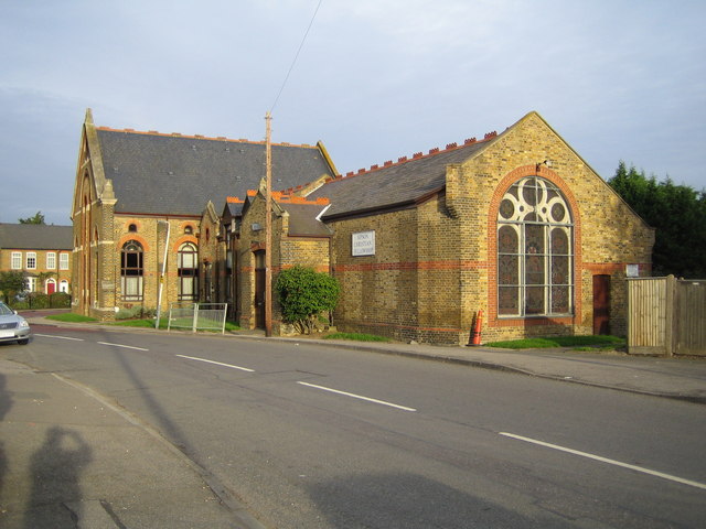
Image: © Nigel Cox Taken: 2 Sep 2006
This chapel is on the corner of the junction of Sipson Lane with Sipson Road. The 1881 Ordnance Survey map does not show any building here at all, but there are records of a Salvation Army Hall from 1891 and a Baptist Church from 1907 on this site. The larger building in the distance and some of the nearer lower part have been converted into residential use, but Sipson Christian Fellowship occupy the nearer end of the lower part. The 1881 map shows Sipson as a small community surrounded on all sides by orchards. The whole village is threatened by the plans for a possible third runway at Heathrow Airport.
Images are licensed for reuse under creativecommons.org/licenses/by-sa/2.0
Image Location
Latitude
51.489896
Longitude
-0.457352