Former air raid shelter
Introduction
The photograph on this page of Former air raid shelter by Colin Craig as part of the Geograph project.
The Geograph project started in 2005 with the aim of publishing, organising and preserving representative images for every square kilometre of Great Britain, Ireland and the Isle of Man.

There are currently over 7.5m images from over 14,400 individuals and you can help contribute to the project by visiting https://www.geograph.org.uk
Former air raid shelter
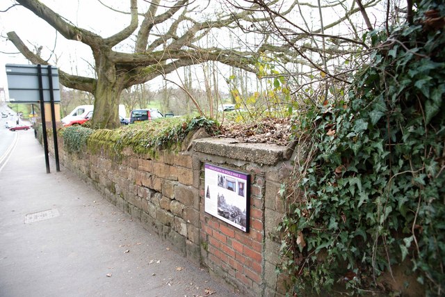
Image: © Colin Craig Taken: 20 Mar 2011
The plaque on this wall marks the bricked up entrance to a second world war air raid shelter built in Kenilworth. The structure still survives underground and continues as a mound over the other side of the wall. It stretches as far as the tree seen in the picture. The plaque gives details of this and some other war remains in the town.
Images are licensed for reuse under creativecommons.org/licenses/by-sa/2.0
Image Location
Latitude
52.349466
Longitude
-1.580821