Signs for the road to Applecross in 1975
Introduction
The photograph on this page of Signs for the road to Applecross in 1975 by Francis W Chadwick as part of the Geograph project.
The Geograph project started in 2005 with the aim of publishing, organising and preserving representative images for every square kilometre of Great Britain, Ireland and the Isle of Man.

There are currently over 7.5m images from over 14,400 individuals and you can help contribute to the project by visiting https://www.geograph.org.uk
Signs for the road to Applecross in 1975
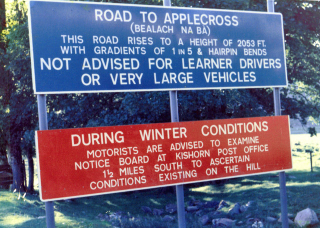
Image: © Francis W Chadwick Taken: 24 Jun 1975
These were the signs by the junction of the A896 road and the old road to Applecross, which were erected before the alternative road along the coast had opened. The original road through Bealach na Bà (the Pass of the Cattle) was and is notorious for its steepness, narrowness and hairpin bends. It is still open (when weather conditions permit), but the new road gives a useful alternative. Not long after this photo was taken, the new road had opened. The signs then changed, as shown in this photograph from 1980:- Image
Images are licensed for reuse under creativecommons.org/licenses/by-sa/2.0
Image Location
Latitude
57.418558
Longitude
-5.602518