Converted farm buildings, East Heddon
Introduction
The photograph on this page of Converted farm buildings, East Heddon by Andrew Curtis as part of the Geograph project.
The Geograph project started in 2005 with the aim of publishing, organising and preserving representative images for every square kilometre of Great Britain, Ireland and the Isle of Man.

There are currently over 7.5m images from over 14,400 individuals and you can help contribute to the project by visiting https://www.geograph.org.uk
Converted farm buildings, East Heddon
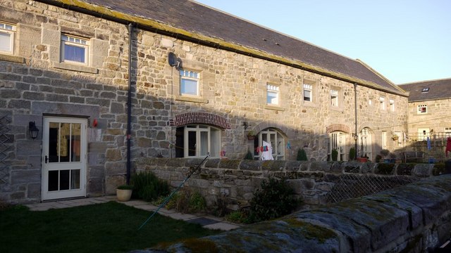
Image: © Andrew Curtis Taken: 22 Jan 2009
The former byre and shelter sheds north of East Heddon are a Grade II Listed Building thought to have been a house originally, then shelter sheds and granary, now dwelling, dating to C16th or early C17th, extended and altered later. List Entry Number: 1154814 https://www.historicengland.org.uk/listing/the-list/list-entry/1154814
Images are licensed for reuse under creativecommons.org/licenses/by-sa/2.0
Image Location
Latitude
55.011154
Longitude
-1.794974