Former chapel, East Street
Introduction
The photograph on this page of Former chapel, East Street by Graham Horn as part of the Geograph project.
The Geograph project started in 2005 with the aim of publishing, organising and preserving representative images for every square kilometre of Great Britain, Ireland and the Isle of Man.

There are currently over 7.5m images from over 14,400 individuals and you can help contribute to the project by visiting https://www.geograph.org.uk
Former chapel, East Street
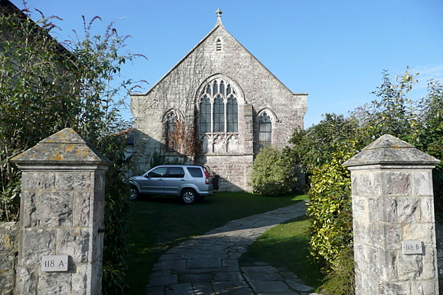
Image: © Graham Horn Taken: 12 Mar 2011
This is shown on the map as a place of worship, without spire or tower. But it surely looks as though it is now private residences, 118 A and 118B on the gateposts being a clue to me anyway.
Images are licensed for reuse under creativecommons.org/licenses/by-sa/2.0
Image Location


Leaflet Map data © OpenStreetMap
Latitude
50.634262
Longitude
-2.054527