Minchinhampton, market tollboard
Introduction
The photograph on this page of Minchinhampton, market tollboard by Mike Faherty as part of the Geograph project.
The Geograph project started in 2005 with the aim of publishing, organising and preserving representative images for every square kilometre of Great Britain, Ireland and the Isle of Man.

There are currently over 7.5m images from over 14,400 individuals and you can help contribute to the project by visiting https://www.geograph.org.uk
Minchinhampton, market tollboard
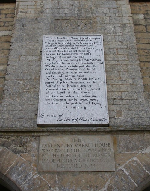
Image: © Mike Faherty Taken: 13 Mar 2011
On the north-eastern wall of Image, showing old market fees. According to OED, cubs are stalls or pens, in dialect. Also shown, eroded datestone from 1698, and restoration details.
Images are licensed for reuse under creativecommons.org/licenses/by-sa/2.0
Image Location
Latitude
51.705432
Longitude
-2.185764