Canvey Island: Former Occidental Petroleum jetty at Holehaven Creek
Introduction
The photograph on this page of Canvey Island: Former Occidental Petroleum jetty at Holehaven Creek by Nigel Cox as part of the Geograph project.
The Geograph project started in 2005 with the aim of publishing, organising and preserving representative images for every square kilometre of Great Britain, Ireland and the Isle of Man.

There are currently over 7.5m images from over 14,400 individuals and you can help contribute to the project by visiting https://www.geograph.org.uk
Canvey Island: Former Occidental Petroleum jetty at Holehaven Creek
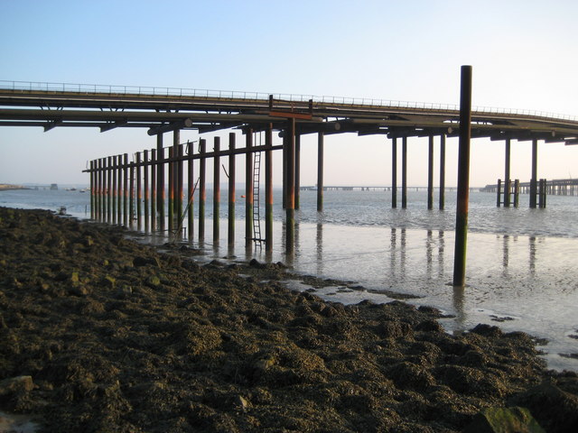
Image: © Nigel Cox Taken: 8 Mar 2011
When Occidental Petroleum planned to develop the western end of Canvey Island as an oil terminal they had to build a jetty from the site out across Holehaven Creek to the River Thames where a deep water anchorage could be found for their tankers. In the event planning permission for the site was rescinded, and Occidental abandoned the project in 1975. All the landward oil terminal infrastructure was subsequently eventually demolished, but 36 years after it was abandoned the jetty still stands. The far end can be seen through the near piers. It is about 1,555 metres long, to within +/- 10 metres, as measured using the satellite imagery and scrolling co-ordinates on the Where's the Path website.
Images are licensed for reuse under creativecommons.org/licenses/by-sa/2.0
Image Location
Latitude
51.517714
Longitude
0.546648