Great Central Way, Leicester
Introduction
The photograph on this page of Great Central Way, Leicester by Malc McDonald as part of the Geograph project.
The Geograph project started in 2005 with the aim of publishing, organising and preserving representative images for every square kilometre of Great Britain, Ireland and the Isle of Man.

There are currently over 7.5m images from over 14,400 individuals and you can help contribute to the project by visiting https://www.geograph.org.uk
Great Central Way, Leicester
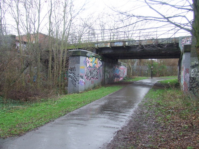
Image: © Malc McDonald Taken: 27 Feb 2011
This path now occupies the route of the Great Central Railway through part of Leicester. The railway closed in 1969. Here the path passes beneath another railway line. As it does so, it climbs a slope and bends round to the right, to pass alongside buildings which now occupy the former railway. To the left, behind the trees, you can just about make out the level of the railway tracks.
Images are licensed for reuse under creativecommons.org/licenses/by-sa/2.0
Image Location
Latitude
52.62108
Longitude
-1.149264