Great Central Way, Leicester
Introduction
The photograph on this page of Great Central Way, Leicester by Malc McDonald as part of the Geograph project.
The Geograph project started in 2005 with the aim of publishing, organising and preserving representative images for every square kilometre of Great Britain, Ireland and the Isle of Man.

There are currently over 7.5m images from over 14,400 individuals and you can help contribute to the project by visiting https://www.geograph.org.uk
Great Central Way, Leicester
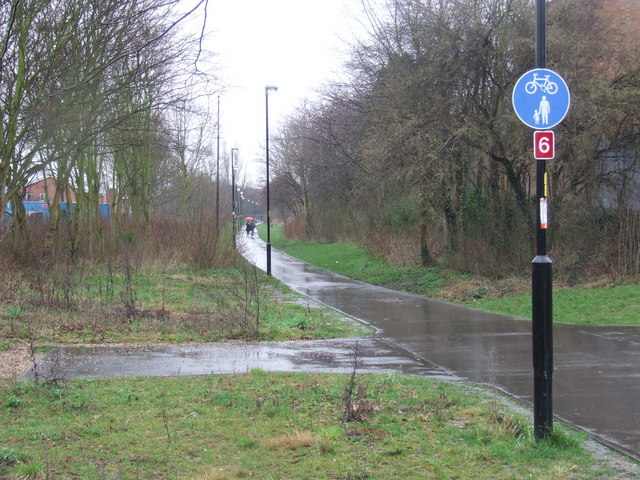
Image: © Malc McDonald Taken: 27 Feb 2011
The Great Central Way is a shared footpath and cycle route, following a section of the route of the former Great Central Railway. The Railway was the last main line railway to be built in the Victorian era, opening in 1899. It ran from London's Marylebone station through Leicester and Nottingham to Sheffield and Manchester. The line closed in 1969. The red sign with the number 6 signifies that this forms part of National Cycle Network route 6. Route 6 links London with Keswick in the Lake District. It is part of a national network of cycle routes mainly using quiet roads and traffic-free paths. Former railway lines make good cycle routes since they generally don't have steep gradients.
Images are licensed for reuse under creativecommons.org/licenses/by-sa/2.0
Image Location
Latitude
52.625198
Longitude
-1.146821