Byrehill Jct, near Kilwinning (1)
Introduction
The photograph on this page of Byrehill Jct, near Kilwinning (1) by Albert Bridge as part of the Geograph project.
The Geograph project started in 2005 with the aim of publishing, organising and preserving representative images for every square kilometre of Great Britain, Ireland and the Isle of Man.

There are currently over 7.5m images from over 14,400 individuals and you can help contribute to the project by visiting https://www.geograph.org.uk
Byrehill Jct, near Kilwinning (1)
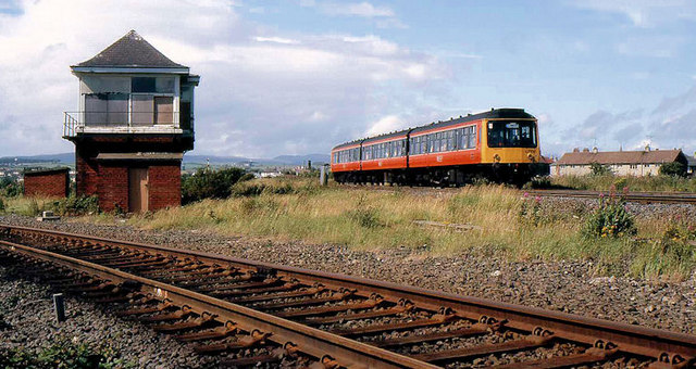
Image: © Albert Bridge Taken: 2 Aug 1985
Byrehill Jct, south of Kilwinning station, was the junction for a loop (foreground) from the Glasgow – Stranraer line to Dubbs Jct on the line from Kilwinning to Largs and Ardrossan. It closed to passengers in 1977 but remained available for freight. The train is the 15-00 Glasgow Central – Ayr. See also Image
Images are licensed for reuse under creativecommons.org/licenses/by-sa/2.0
Image Location
Latitude
55.644074
Longitude
-4.702363