Green Chain Walk on Thamesmead
Introduction
The photograph on this page of Green Chain Walk on Thamesmead by Marathon as part of the Geograph project.
The Geograph project started in 2005 with the aim of publishing, organising and preserving representative images for every square kilometre of Great Britain, Ireland and the Isle of Man.

There are currently over 7.5m images from over 14,400 individuals and you can help contribute to the project by visiting https://www.geograph.org.uk
Green Chain Walk on Thamesmead
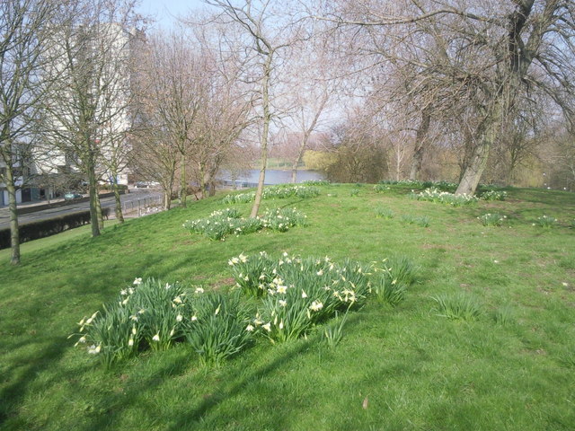
Image: © Marathon Taken: 8 Mar 2011
The Green Chain Walk though Thamesmead is here seen as it approaches the lake at Southmere. One of the ubiquitous Thamesmead tower blocks can be seen on the left. Because of fears over flooding from the Thames as much of this area is below high tide level, the first parts of Thamesmead as here were built with all living accommodation at first floor level or above.
Images are licensed for reuse under creativecommons.org/licenses/by-sa/2.0
Image Location
Latitude
51.498904
Longitude
0.127752