Bridgewater Canal, Monton
Introduction
The photograph on this page of Bridgewater Canal, Monton by David Dixon as part of the Geograph project.
The Geograph project started in 2005 with the aim of publishing, organising and preserving representative images for every square kilometre of Great Britain, Ireland and the Isle of Man.

There are currently over 7.5m images from over 14,400 individuals and you can help contribute to the project by visiting https://www.geograph.org.uk
Bridgewater Canal, Monton
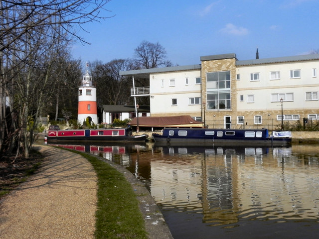
Image: © David Dixon Taken: 8 Mar 2011
The Bridgewater Canal at Monton. To the left on the opposite bank is "Monton Lighthouse", a 36 foot high folly built by a local resident (for more information see this http://menmedia.co.uk/manchestereveningnews/news/s/155/155781_lighthouse_family_at_home_on_canal.html in the Manchester Evening News)
Images are licensed for reuse under creativecommons.org/licenses/by-sa/2.0
Image Location
Latitude
53.491763
Longitude
-2.357324