Crumlin Viaduct depicted in The Bridgend Inn sign
Introduction
The photograph on this page of Crumlin Viaduct depicted in The Bridgend Inn sign by Jaggery as part of the Geograph project.
The Geograph project started in 2005 with the aim of publishing, organising and preserving representative images for every square kilometre of Great Britain, Ireland and the Isle of Man.

There are currently over 7.5m images from over 14,400 individuals and you can help contribute to the project by visiting https://www.geograph.org.uk
Crumlin Viaduct depicted in The Bridgend Inn sign
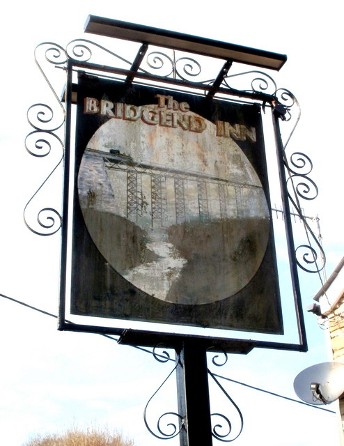
Image: © Jaggery Taken: 17 Feb 2011
The Inn's http://www.geograph.org.uk/photo/2299107 sign depicts the Crumlin Viaduct, which opened in 1857 and closed in 1964. At 200 feet high at the highest point above the valley floor, and 1650 feet long (two spans, 1066 feet and 584 feet), it was the highest railway viaduct in Great Britain throughout its working existence. It was built by the contractor T. W. Kennard. The pub is on the corner of Kennard Terrace.
Images are licensed for reuse under creativecommons.org/licenses/by-sa/2.0
Image Location
Latitude
51.677874
Longitude
-3.145402