Trongate 1967
Introduction
The photograph on this page of Trongate 1967 by Gerald England as part of the Geograph project.
The Geograph project started in 2005 with the aim of publishing, organising and preserving representative images for every square kilometre of Great Britain, Ireland and the Isle of Man.

There are currently over 7.5m images from over 14,400 individuals and you can help contribute to the project by visiting https://www.geograph.org.uk
Trongate 1967
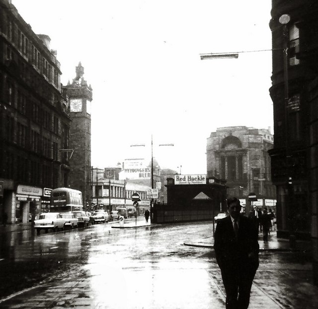
Image: © Gerald England Taken: Unknown
On the left is the seven-storey Tolbooth Steeple erected around 1625 and topped by a clock and a stone crown. This was once part of a much larger building, the Tolbooth. On the right is the Mercat Building from 1925. The other buildings shown here have been either replaced or severely modernised.
Images are licensed for reuse under creativecommons.org/licenses/by-sa/2.0
Image Location
Latitude
55.856695
Longitude
-4.244587