RAF Shellingford Remnant 2
Introduction
The photograph on this page of RAF Shellingford Remnant 2 by Des Blenkinsopp as part of the Geograph project.
The Geograph project started in 2005 with the aim of publishing, organising and preserving representative images for every square kilometre of Great Britain, Ireland and the Isle of Man.

There are currently over 7.5m images from over 14,400 individuals and you can help contribute to the project by visiting https://www.geograph.org.uk
RAF Shellingford Remnant 2
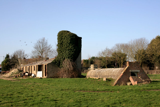
Image: © Des Blenkinsopp Taken: 4 Mar 2011
There are still a few structures remaining from this old WW2 airfield, although most of it has vanished into a sand quarry. Two or three of the old buildings have been incorporated into units on the White Horse business park and are used for this and that, but most of what is left is gradually falling down, much like what you see here. https://military.wikia.org/wiki/RAF_Shellingford
Images are licensed for reuse under creativecommons.org/licenses/by-sa/2.0
Image Location


Leaflet Map data © OpenStreetMap
Latitude
51.633795
Longitude
-1.509424