Rivenhall Aerodrome
Introduction
The photograph on this page of Rivenhall Aerodrome by Glyn Baker as part of the Geograph project.
The Geograph project started in 2005 with the aim of publishing, organising and preserving representative images for every square kilometre of Great Britain, Ireland and the Isle of Man.

There are currently over 7.5m images from over 14,400 individuals and you can help contribute to the project by visiting https://www.geograph.org.uk
Rivenhall Aerodrome
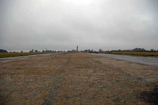
Image: © Glyn Baker Taken: 26 Aug 2006
This is the main runway of the former Rivenhall Aerodrome. It is one of the few in Essex to have survived with its full 100 feet width intact. Most have been robbed out to the width of farm tracks for hard core. Sadly Rivenhall too is about to suffer this fate see Image Rivenhall began operations in January 1944 using P51s these were later replaced with B26 bombers. The USAAF left the base in August 1944, RAF Sterling Glider tugs and SOE transports moving in during the autumn. The base closed in 1946. To go to the next field in an alphabetical tour of Essex WW2 airfields click on Image Much information was gleaned from Graham Smith’s book “Essex Airfields In The Second World War” https://books.google.co.uk/books/about/Essex_Airfields_in_the_Second_World_War.html?id=u3atAAAACAAJ&redir_esc=y
Images are licensed for reuse under creativecommons.org/licenses/by-sa/2.0
Image Location
Latitude
51.855654
Longitude
0.653554