Winforton Wayside Cross Socket Stone
Introduction
The photograph on this page of Winforton Wayside Cross Socket Stone by Christopher Clift as part of the Geograph project.
The Geograph project started in 2005 with the aim of publishing, organising and preserving representative images for every square kilometre of Great Britain, Ireland and the Isle of Man.

There are currently over 7.5m images from over 14,400 individuals and you can help contribute to the project by visiting https://www.geograph.org.uk
Winforton Wayside Cross Socket Stone
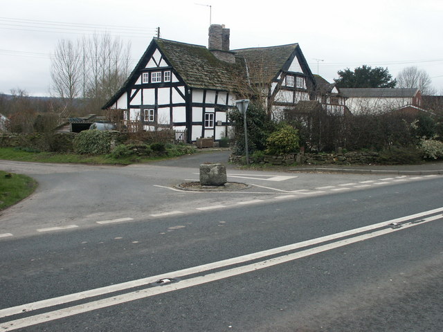
Image: © Christopher Clift Taken: 24 Feb 2004
All that remains of the wayside Cross in the centre of Winforton is the socket stone. The location has been known as "The Stocks", and is on the A438.
Images are licensed for reuse under creativecommons.org/licenses/by-sa/2.0
Image Location
Latitude
52.117292
Longitude
-3.026796