The Wrens Nest (1), 46 Stourport Road, Kidderminster
Introduction
The photograph on this page of The Wrens Nest (1), 46 Stourport Road, Kidderminster by P L Chadwick as part of the Geograph project.
The Geograph project started in 2005 with the aim of publishing, organising and preserving representative images for every square kilometre of Great Britain, Ireland and the Isle of Man.

There are currently over 7.5m images from over 14,400 individuals and you can help contribute to the project by visiting https://www.geograph.org.uk
The Wrens Nest (1), 46 Stourport Road, Kidderminster
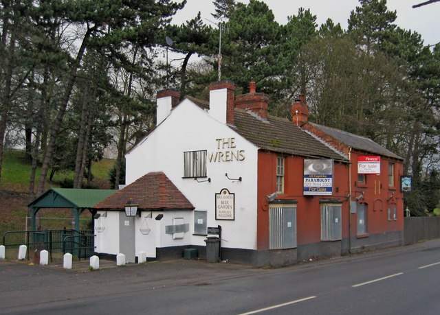
Image: © P L Chadwick Taken: 27 Feb 2011
Recently closed and put up for sale. It has a long history, as in the 1881 Census it is shown as the Wrens Nest Beerhouse. It could even be a bit older than that. In recent years it seems to have been known as The Wrens, but the sign still says The Wrens Nest. The green structure appears to be a smoking shelter. The original shelter was burned down in a fire in April 2010. Image Image Update June 2014:- Image
Images are licensed for reuse under creativecommons.org/licenses/by-sa/2.0
Image Location


Leaflet Map data © OpenStreetMap
Latitude
52.379328
Longitude
-2.256454