Field beside the Hoddnant - Boverton
Introduction
The photograph on this page of Field beside the Hoddnant - Boverton by Mick Lobb as part of the Geograph project.
The Geograph project started in 2005 with the aim of publishing, organising and preserving representative images for every square kilometre of Great Britain, Ireland and the Isle of Man.

There are currently over 7.5m images from over 14,400 individuals and you can help contribute to the project by visiting https://www.geograph.org.uk
Field beside the Hoddnant - Boverton
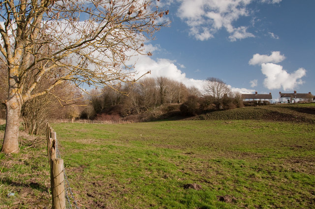
Image: © Mick Lobb Taken: 26 Feb 2011
Part of the settlement of Trebeferad can be seen on the skyline to the right.This was established under the Land Settlement Scheme of 1936 and described as a '600 acre jewel in the crown of the Welsh Land Settlement Association'. It provided employment and a healthier outlook for between 60-70 unemployed miners and their families during the years of the depression of the 1930's. Pigs, sheep and poultry were kept by those working here and there was a thriving market gardening enterprise. Crops cultivated included spring cabbage, peas, carrots, brussels sprouts and fruit such as strawberries. Three acres of glasshouses were also provided for the production of tomatoes. Produce was primarily sold locally but also as far afield as the west-country. Sixty houses were provided for families and planned in a garden village style, the architect being Alwyn Lloyd who based it on plans adopted by the Welsh Garden Cities Association who campaigned for better housing for the people of Wales.
Images are licensed for reuse under creativecommons.org/licenses/by-sa/2.0
Image Location
Latitude
51.404239
Longitude
-3.469075