Southbury Loop Railway Line
Introduction
The photograph on this page of Southbury Loop Railway Line by Martin Addison as part of the Geograph project.
The Geograph project started in 2005 with the aim of publishing, organising and preserving representative images for every square kilometre of Great Britain, Ireland and the Isle of Man.

There are currently over 7.5m images from over 14,400 individuals and you can help contribute to the project by visiting https://www.geograph.org.uk
Southbury Loop Railway Line
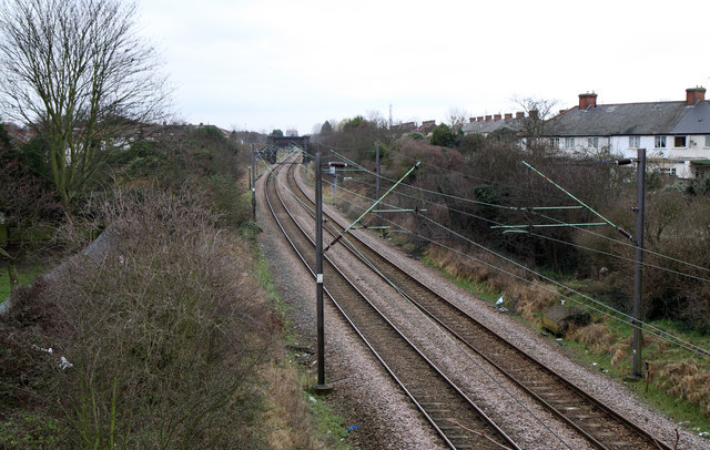
Image: © Martin Addison Taken: 12 Feb 2011
Seen from the bridge carrying Carterhatch Lane. The line leaves the Enfield Town branch north of Edmonton Green and connects to the Liverpool Street to Cambridge mainline at Cheshunt. The line was opened in 1891 by the Great Eastern Railway and was originally known as the Churchbury Loop. Passenger services were short-lived in the early life of the line as the arrival of trams to Waltham Cross took away the trade. It survived as a freight route until the Great Eastern electrification by British Railways in the 1960's when passenger services were restored. Currently the passenger services route from Liverpool Street to Hertford East.
Images are licensed for reuse under creativecommons.org/licenses/by-sa/2.0
Image Location
Latitude
51.659356
Longitude
-0.049522