Cargill Stone, Cargill Court, Maybole
Introduction
The photograph on this page of Cargill Stone, Cargill Court, Maybole by Becky Williamson as part of the Geograph project.
The Geograph project started in 2005 with the aim of publishing, organising and preserving representative images for every square kilometre of Great Britain, Ireland and the Isle of Man.

There are currently over 7.5m images from over 14,400 individuals and you can help contribute to the project by visiting https://www.geograph.org.uk
Cargill Stone, Cargill Court, Maybole
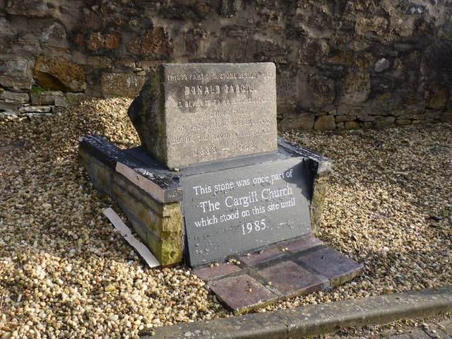
Image: © Becky Williamson Taken: 15 Feb 2011
This stone was rescued from the Cargill Memorial Church in Maybole when it was demolished in 1985. The stone was originally located to the north of the town, where a monument commemorates all of the Covenanters of the district (see http://www.geograph.org.uk/photo/2278703 ) but it was broken and part of it was incorporated in the Cargill church. The stone lay in the yard of a local builder for a few years before it was rescued and incorporated into this small memorial, located at the entrance to Cargill Court, the new houses erected on the site of the church. The stone was unveiled at a conventicle on Sunday 5th November 2006. The Cargill Stone was the location of a number of conventicles held by Rev. Donald Cargill and others during the time of the struggles. Cargill’s last conventicle here took place in 1681, just two months before he was arrested at Covington in Lanarkshire and subsequently executed in Edinburgh. (Information from the Scottish Covenanter Memorials Association)
Images are licensed for reuse under creativecommons.org/licenses/by-sa/2.0
Image Location
Latitude
55.355719
Longitude
-4.681411