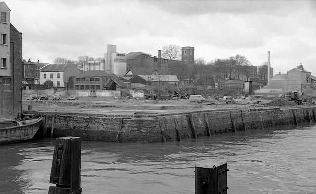
Riverside redevelopment site in Woolwich
Introduction
The photograph on this page of Riverside redevelopment site in Woolwich by Roger D Kidd as part of the Geograph project.
The Geograph project started in 2005 with the aim of publishing, organising and preserving representative images for every square kilometre of Great Britain, Ireland and the Isle of Man.
There are currently over 7.5m images from over 14,400 individuals and you can help contribute to the project by visiting https://www.geograph.org.uk

Image: © Roger D Kidd Taken: 1 Apr 1964
Seen from the pedestrian walkway on the upstream side of the old ferry jetty. Landmarks are the Odeon Cinema (now a church) and the square tower of St Mary Magdalene Church on the skyline. There is another image from a few days earlier revealing that part of the site under demolition was the British Road Services Woolwich Depot. Image John Webb recalls that the former flour mill on the site is just visible on the left of the photo - the hoist used to remove sacks of grain from barges is the protruding white structure just visible. The image has been scanned from a 35mm Ilford FP3 monochrome negative, date circa April 1964.

