Douglas Park, Largs
Introduction
The photograph on this page of Douglas Park, Largs by Lairich Rig as part of the Geograph project.
The Geograph project started in 2005 with the aim of publishing, organising and preserving representative images for every square kilometre of Great Britain, Ireland and the Isle of Man.

There are currently over 7.5m images from over 14,400 individuals and you can help contribute to the project by visiting https://www.geograph.org.uk
Douglas Park, Largs
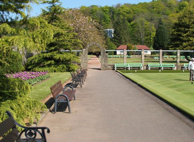
Image: © Lairich Rig Taken: 13 May 2005
This photograph shows the north-western corner of the park. The bowling green, part of which can be seen here, is also shown in Image The park also includes a Victorian Garden (Image) and a Robert Burns Memorial Garden (Image). The Burns Garden is located just behind the building with the brick-red roof (later demolished — Image), but Douglas Park itself extends considerably further. However, the modern building set on the slope in the background, among the trees, does not lie within the park, but is one of the properties in Bankhouse Grove.
Images are licensed for reuse under creativecommons.org/licenses/by-sa/2.0
Image Location


Leaflet Map data © OpenStreetMap
Latitude
55.789112
Longitude
-4.859017