Embankment and broad gauge railway line
Introduction
The photograph on this page of Embankment and broad gauge railway line by Natasha Ceridwen de Chroustchoff as part of the Geograph project.
The Geograph project started in 2005 with the aim of publishing, organising and preserving representative images for every square kilometre of Great Britain, Ireland and the Isle of Man.

There are currently over 7.5m images from over 14,400 individuals and you can help contribute to the project by visiting https://www.geograph.org.uk
Embankment and broad gauge railway line
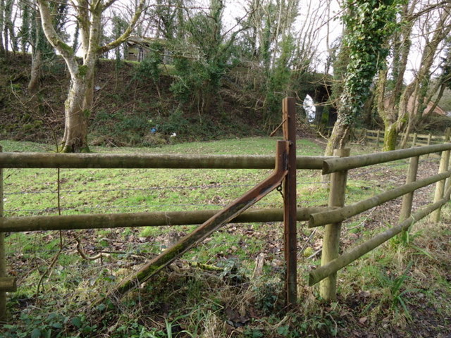
Image: © Natasha Ceridwen de Chroustchoff Taken: 3 Feb 2011
Here, just below The Drim and looking west towards the Dyffryn area of Goodwick, are some interesting railway relics. In the foreground is a fence post made from redundant sections of the old 7 foot gauge railway line adopted by Brunel for the GWR and used until 1892 when all tracks were converted to standard gauge. Behind can be seen an embankment and bridge constructed with the intention of opening an alternative route for the line between Goodwick station and Letterston junction. The scheme was interrupted by WW1 and never completed. [Thanks to Roy Lewis for the information about the Brunel gauge fencing.]
Images are licensed for reuse under creativecommons.org/licenses/by-sa/2.0
Image Location
Latitude
51.99422
Longitude
-4.998329