Otterton Mill
Introduction
The photograph on this page of Otterton Mill by Chris Allen as part of the Geograph project.
The Geograph project started in 2005 with the aim of publishing, organising and preserving representative images for every square kilometre of Great Britain, Ireland and the Isle of Man.

There are currently over 7.5m images from over 14,400 individuals and you can help contribute to the project by visiting https://www.geograph.org.uk
Otterton Mill
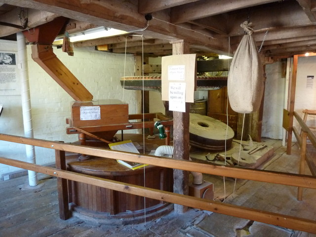
Image: © Chris Allen Taken: 12 Feb 2011
This is the western side of the mill with one set of clothed and working stones and one set that are unclothed. The crown wheel is visible and drives the sack hoist. The elephant tubing is to keep the stones dry.
Images are licensed for reuse under creativecommons.org/licenses/by-sa/2.0
Image Location
Latitude
50.659538
Longitude
-3.303377