South Tottenham East Junction
Introduction
The photograph on this page of South Tottenham East Junction by Robin Webster as part of the Geograph project.
The Geograph project started in 2005 with the aim of publishing, organising and preserving representative images for every square kilometre of Great Britain, Ireland and the Isle of Man.

There are currently over 7.5m images from over 14,400 individuals and you can help contribute to the project by visiting https://www.geograph.org.uk
South Tottenham East Junction
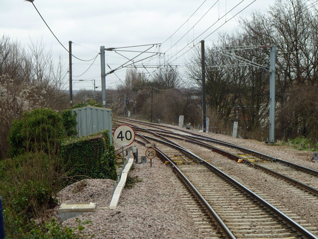
Image: © Robin Webster Taken: 5 Feb 2011
The original Tottenham and Hampstead line is the right route on an easy curve. The later Tottenham and Forest Gate line goes left on a sharper curve. As may be seen from the speed limits, the cant at the junction has been optimised for the Forest Gate route. This became the more important route early on, linking the London, Tilbury and Southend Railway with the rest of the network and avoiding the Great Eastern. It was the only independent link the Midland Railway had with their new purchase when they took over the LTSR in 1912. Today it carries the Overground Gospel Oak - Barking service as well as freight.
Images are licensed for reuse under creativecommons.org/licenses/by-sa/2.0
Image Location
Latitude
51.580747
Longitude
-0.070355