The Green Island, Belfast Lough
Introduction
The photograph on this page of The Green Island, Belfast Lough by Albert Bridge as part of the Geograph project.
The Geograph project started in 2005 with the aim of publishing, organising and preserving representative images for every square kilometre of Great Britain, Ireland and the Isle of Man.

There are currently over 7.5m images from over 14,400 individuals and you can help contribute to the project by visiting https://www.geograph.org.uk
The Green Island, Belfast Lough
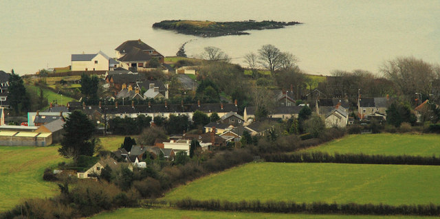
Image: © Albert Bridge Taken: 5 Feb 2011
A small island (not shown on the Google map but visible on the satellite photograph) close to the Co Antrim shore of Belfast Lough, which has given its name to the surrounding area. Although the locality is known as Greenisland, the townland seems to be West Division. The view is from Knockagh just under three hours before high water Carrickfergus.
Images are licensed for reuse under creativecommons.org/licenses/by-sa/2.0
Image Location
Latitude
54.695722
Longitude
-5.848434