Penponds Methodist Church
Introduction
The photograph on this page of Penponds Methodist Church by Rod Allday as part of the Geograph project.
The Geograph project started in 2005 with the aim of publishing, organising and preserving representative images for every square kilometre of Great Britain, Ireland and the Isle of Man.

There are currently over 7.5m images from over 14,400 individuals and you can help contribute to the project by visiting https://www.geograph.org.uk
Penponds Methodist Church
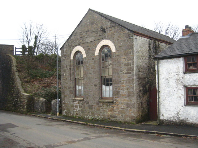
Image: © Rod Allday Taken: 4 Feb 2011
Built as a Bible Christians Chapel in 1844, as noted on the stone on the gable end. Grade II listed http://www.imagesofengland.org.uk/Details/Default.aspx?id=66577&mode=adv. The embankment of the Paddington-Penzance main line railway is immediately adjacent to the church.
Images are licensed for reuse under creativecommons.org/licenses/by-sa/2.0
Image Location


Leaflet Map data © OpenStreetMap
Latitude
50.205928
Longitude
-5.314761