River Tame, Delph Bridge
Introduction
The photograph on this page of River Tame, Delph Bridge by David Dixon as part of the Geograph project.
The Geograph project started in 2005 with the aim of publishing, organising and preserving representative images for every square kilometre of Great Britain, Ireland and the Isle of Man.

There are currently over 7.5m images from over 14,400 individuals and you can help contribute to the project by visiting https://www.geograph.org.uk
River Tame, Delph Bridge
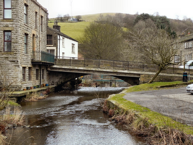
Image: © David Dixon Taken: 3 Feb 2011
Looking downstream, as the Tame passes under High Street at Delph. The view of this side of the bridge is dominated by the footway added during the 20th century. The main part of the bridge (stonework and arch, behind the walkway) probably dates from the 18th century. It is a Grade II Listed structure (http://www.britishlistedbuildings.co.uk/en-212142-delph-bridge-saddleworth English Heritage)
Images are licensed for reuse under creativecommons.org/licenses/by-sa/2.0
Image Location


Leaflet Map data © OpenStreetMap
Latitude
53.568283
Longitude
-2.023864