Benchmark on Capel Horeb, Garndolbenmaen
Introduction
The photograph on this page of Benchmark on Capel Horeb, Garndolbenmaen by Meirion as part of the Geograph project.
The Geograph project started in 2005 with the aim of publishing, organising and preserving representative images for every square kilometre of Great Britain, Ireland and the Isle of Man.

There are currently over 7.5m images from over 14,400 individuals and you can help contribute to the project by visiting https://www.geograph.org.uk
Benchmark on Capel Horeb, Garndolbenmaen
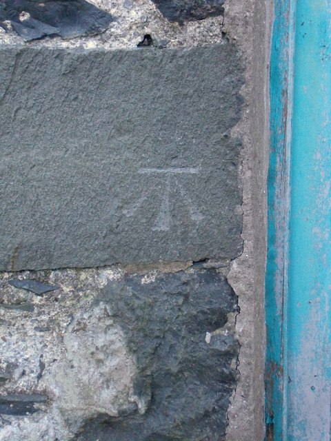
Image: © Meirion Taken: 27 Jan 2011
This benchmark is located on the NW face of Capel Horeb in Garndolbenmaen & it is shown in the current Ordnance Survey database at a height of 140.7475m above the Newlyn datum. See also: Image
Images are licensed for reuse under creativecommons.org/licenses/by-sa/2.0
Image Location
Latitude
52.973931
Longitude
-4.239784