The wrong sign
Introduction
The photograph on this page of The wrong sign by Peter Whatley as part of the Geograph project.
The Geograph project started in 2005 with the aim of publishing, organising and preserving representative images for every square kilometre of Great Britain, Ireland and the Isle of Man.

There are currently over 7.5m images from over 14,400 individuals and you can help contribute to the project by visiting https://www.geograph.org.uk
The wrong sign
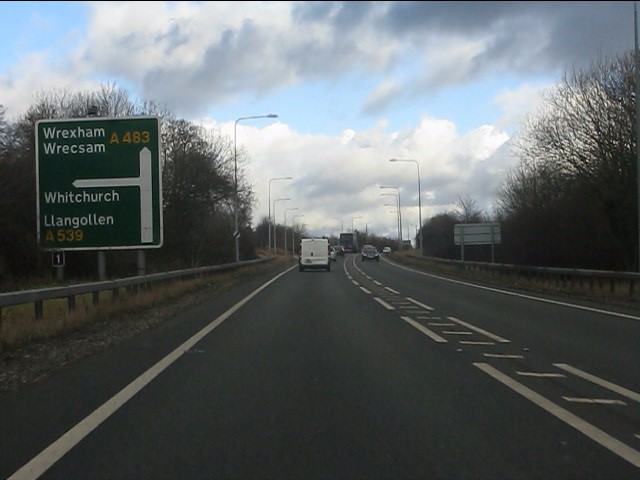
Image: © Peter Whatley Taken: 18 Jan 2011
Something of a "lash-up" on the A483 approaching Ruabon. Possibly it reflects the nature of the junction prior to dualling. The junction is now a motorway-style intersection and should have a "fork" sign. Note the junction number (1) fixed to the left hand support, rather than the sign itself.
Images are licensed for reuse under creativecommons.org/licenses/by-sa/2.0
Image Location


Leaflet Map data © OpenStreetMap
Latitude
52.981031
Longitude
-3.041949