St Chad's Church, Wybunbury
Introduction
The photograph on this page of St Chad's Church, Wybunbury by Richard Dorrell as part of the Geograph project.
The Geograph project started in 2005 with the aim of publishing, organising and preserving representative images for every square kilometre of Great Britain, Ireland and the Isle of Man.

There are currently over 7.5m images from over 14,400 individuals and you can help contribute to the project by visiting https://www.geograph.org.uk
St Chad's Church, Wybunbury
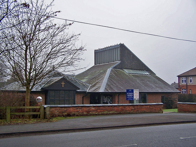
Image: © Richard Dorrell Taken: 22 Jan 2011
This is the modern St Chad's, located in Main Road. It was built to replace the former St Chad's which was demolished in 1976, having become unsafe due to subsidence. The tower of the old church remains, and is located in grid square Image
Images are licensed for reuse under creativecommons.org/licenses/by-sa/2.0
Image Location
Latitude
53.045318
Longitude
-2.454004