Teversal Station
Introduction
The photograph on this page of Teversal Station by Trevor Rickard as part of the Geograph project.
The Geograph project started in 2005 with the aim of publishing, organising and preserving representative images for every square kilometre of Great Britain, Ireland and the Isle of Man.

There are currently over 7.5m images from over 14,400 individuals and you can help contribute to the project by visiting https://www.geograph.org.uk
Teversal Station
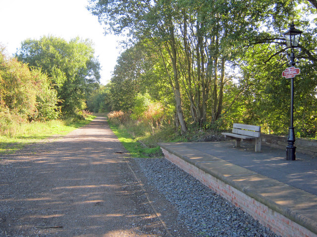
Image: © Trevor Rickard Taken: 25 Sep 2010
Looking north-east along the old line to Pleasley, which forms part of the Teversal Trails. The old station platform has been nicely restored and now provides a place to rest for walkers and cyclists.
Images are licensed for reuse under creativecommons.org/licenses/by-sa/2.0
Image Location
Latitude
53.147075
Longitude
-1.288275