Colney Heath: The Crooked Billet
Introduction
The photograph on this page of Colney Heath: The Crooked Billet by Nigel Cox as part of the Geograph project.
The Geograph project started in 2005 with the aim of publishing, organising and preserving representative images for every square kilometre of Great Britain, Ireland and the Isle of Man.

There are currently over 7.5m images from over 14,400 individuals and you can help contribute to the project by visiting https://www.geograph.org.uk
Colney Heath: The Crooked Billet
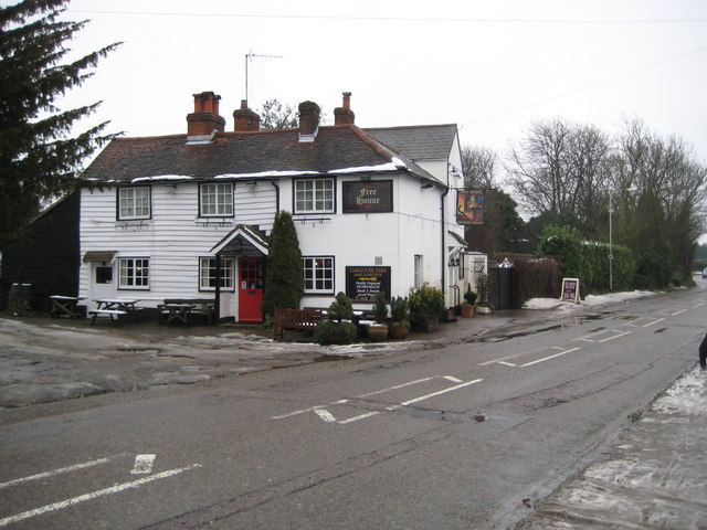
Image: © Nigel Cox Taken: 14 Jan 2010
This Grade II Listed pub is on the High Street. The English Heritage Listed Buildings website describes the exterior thus:- "Circa early C19 with later C19 extensions. Weatherboarded timber frame with plain tile roof, hipped on right. Rendered brick extension with slate roofs. Brick axial stacks. The original house was a 2-room plan weatherboarded cottage with a central axial stack. The right hand (S) bay was added later in C19 and the back range (E) is even later C19 or early C20. There are outshuts on the left (N) and rear (E) of the original cottage. 2 storeys. 3-window west front. C19 2-light casements with glazing bars. Panelled and glazed door to right of centre with small C20 gabled porch; another door on left with glazed door and canopy. Weatherboarded outshut on left and taller brick range at rear."
Images are licensed for reuse under creativecommons.org/licenses/by-sa/2.0
Image Location
Latitude
51.74001
Longitude
-0.260995