Lordsmill Street, Chesterfield in 1986
Introduction
The photograph on this page of Lordsmill Street, Chesterfield in 1986 by John Baker as part of the Geograph project.
The Geograph project started in 2005 with the aim of publishing, organising and preserving representative images for every square kilometre of Great Britain, Ireland and the Isle of Man.

There are currently over 7.5m images from over 14,400 individuals and you can help contribute to the project by visiting https://www.geograph.org.uk
Lordsmill Street, Chesterfield in 1986
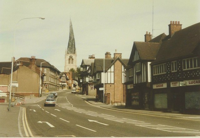
Image: © John Baker Taken: 7 Sep 1986
The road markings on the left hand side of the street would lead a vehicle into New Beetwell Street while the whole view is dominated by the crooked spire of St Mary and All Saints' church
Images are licensed for reuse under creativecommons.org/licenses/by-sa/2.0
Image Location
Latitude
53.235362
Longitude
-1.4242