The Humber Stone - Glacial Erratic
Introduction
The photograph on this page of The Humber Stone - Glacial Erratic by Ashley Dace as part of the Geograph project.
The Geograph project started in 2005 with the aim of publishing, organising and preserving representative images for every square kilometre of Great Britain, Ireland and the Isle of Man.

There are currently over 7.5m images from over 14,400 individuals and you can help contribute to the project by visiting https://www.geograph.org.uk
The Humber Stone - Glacial Erratic
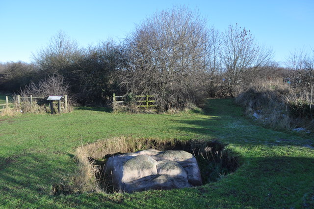
Image: © Ashley Dace Taken: 20 Jan 2011
The Humber stone is a Syenite glacial erratic brought here by ice between 478,000 and 424,000 years ago during the Anglian stage glaciation. Its original location was the Mountsorrel intrusions a few miles north, you can see the chimney of the quarry works from this site. The syenite is a granitic rock, formed when the Tornquist sea closed not long before the Caledonian Orogeny during the Ordovician/Silurian. A subduction zone was sited under the north sea with Avalonia being subducted and later colliding with Baltica. This produced a line of volcanic intrusions deep down running from the Lake District right down to here and even East Anglia. There is magnetic evidence for a pluton underneath the Wash. It is sited next to a roundabout on the Leicester outer ring road, it is signed and has an information board.
Images are licensed for reuse under creativecommons.org/licenses/by-sa/2.0
Image Location
Latitude
52.658047
Longitude
-1.079504