Madelaine Street, Princes Park regeneration zone
Introduction
The photograph on this page of Madelaine Street, Princes Park regeneration zone by John S Turner as part of the Geograph project.
The Geograph project started in 2005 with the aim of publishing, organising and preserving representative images for every square kilometre of Great Britain, Ireland and the Isle of Man.

There are currently over 7.5m images from over 14,400 individuals and you can help contribute to the project by visiting https://www.geograph.org.uk
Madelaine Street, Princes Park regeneration zone
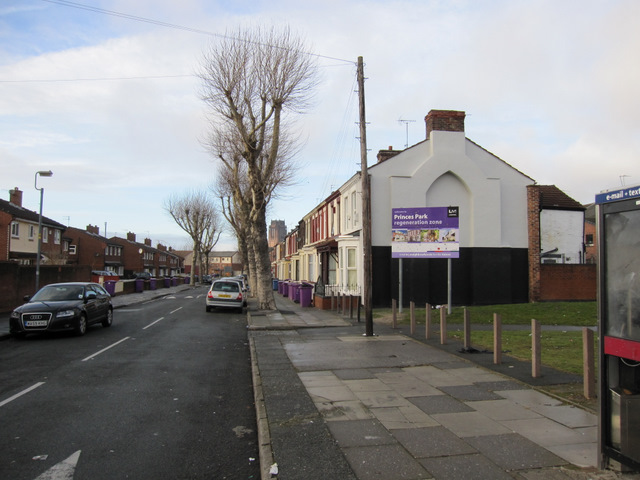
Image: © John S Turner Taken: 6 Jan 2011
Looking north west along Madelaine Street. This entire area is changing as the 19th century terraced housing is swept away and replaced with more modern homes. Immediately on the right the old houses facing North Hill Street have gone, whilst on the right of this street the bay-windowed houses remain. However, on the left of the street the terrace has been replaced with modern housing. To the right of the trees the tower of the Anglican cathedral can be seen in the distance.
Images are licensed for reuse under creativecommons.org/licenses/by-sa/2.0
Image Location
Latitude
53.391169
Longitude
-2.961417