Gairloch : Looking towards Strath
Introduction
The photograph on this page of Gairloch : Looking towards Strath by Ken Bagnall as part of the Geograph project.
The Geograph project started in 2005 with the aim of publishing, organising and preserving representative images for every square kilometre of Great Britain, Ireland and the Isle of Man.

There are currently over 7.5m images from over 14,400 individuals and you can help contribute to the project by visiting https://www.geograph.org.uk
Gairloch : Looking towards Strath
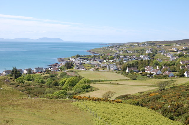
Image: © Ken Bagnall Taken: 12 Jun 2009
Gairloch is a loosely defined area of settlement along the shores of Loch Gairloch, but primarily comprises three main clusters of shops, houses and amenities: the Harbour area (including Charlestown on the south side of the harbour), Achtercairn and Strath. If approaching from the south (via Kinlochewe), Charleston and the harbour are met first. Achtercairn is centred around the road junction with the coastal road that leads west to Strath and on towards Melvaig. The main A832 road heads steeply up Achtercairn Brae leading out of the village to the north and on to Poolewe. The car park at the top of the brae gives fine views over Strath.
Images are licensed for reuse under creativecommons.org/licenses/by-sa/2.0
Image Location
Latitude
57.732515
Longitude
-5.695058