Upper Norwood Public Library
Introduction
The photograph on this page of Upper Norwood Public Library by Christopher Hilton as part of the Geograph project.
The Geograph project started in 2005 with the aim of publishing, organising and preserving representative images for every square kilometre of Great Britain, Ireland and the Isle of Man.

There are currently over 7.5m images from over 14,400 individuals and you can help contribute to the project by visiting https://www.geograph.org.uk
Upper Norwood Public Library
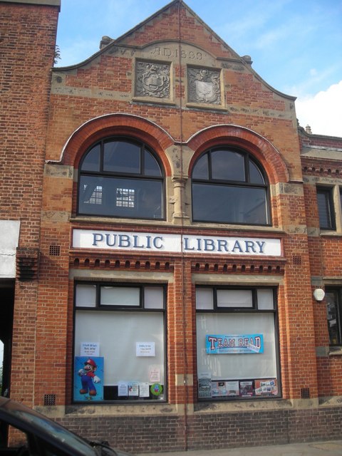
Image: © Christopher Hilton Taken: 27 Jul 2008
Upper Norwood straddles several boundaries: the two most significant local authorities in the area are Lambeth and Croydon (the library is in Lambeth, the photographer is standing in Croydon), although Southwark, Bromley and Lewisham also have a presence. As a result, the Library is jointly funded by the London Boroughs of Lambeth and Croydon, and their predecessors' arms can be seen on the gable end (see Image). For the view through the archway creeping into the left of the shot, see Image
Images are licensed for reuse under creativecommons.org/licenses/by-sa/2.0
Image Location
Latitude
51.420136
Longitude
-0.081154