Former Lloyds Bank, Elvaston Road, Ryton
Introduction
The photograph on this page of Former Lloyds Bank, Elvaston Road, Ryton by Andrew Curtis as part of the Geograph project.
The Geograph project started in 2005 with the aim of publishing, organising and preserving representative images for every square kilometre of Great Britain, Ireland and the Isle of Man.

There are currently over 7.5m images from over 14,400 individuals and you can help contribute to the project by visiting https://www.geograph.org.uk
Former Lloyds Bank, Elvaston Road, Ryton
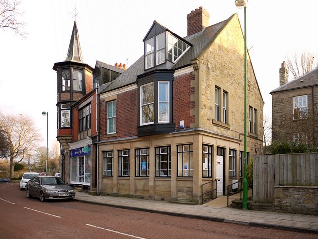
Image: © Andrew Curtis Taken: 3 Jan 2011
The west end of the former Victorian shopping parade on Elvaston Road Image, now mostly converted to residential use, but some of the shop fronts have been retained. One of the shops has an oriel window topped by a turret with a spire. It was built as an observatory. The corner building, the former Lloyds Bank, was probably built as a house in the C19th century, was converted into a bank after 1912. It was disused by 1992 and was converted to a medical Centre. http://www.pastscape.org.uk/hob.aspx?hob_id=1345785
Images are licensed for reuse under creativecommons.org/licenses/by-sa/2.0
Image Location
Latitude
54.976408
Longitude
-1.762343