Barmoor Lane & Elvaston Road, Ryton
Introduction
The photograph on this page of Barmoor Lane & Elvaston Road, Ryton by Andrew Curtis as part of the Geograph project.
The Geograph project started in 2005 with the aim of publishing, organising and preserving representative images for every square kilometre of Great Britain, Ireland and the Isle of Man.

There are currently over 7.5m images from over 14,400 individuals and you can help contribute to the project by visiting https://www.geograph.org.uk
Barmoor Lane & Elvaston Road, Ryton
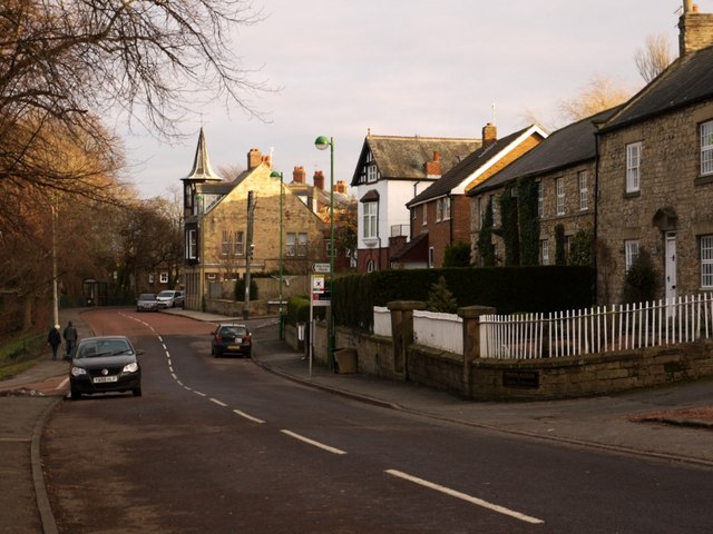
Image: © Andrew Curtis Taken: 3 Jan 2011
Looking east from the Village Green, Barmoor Lane turns into Elvaston Road at the distant junction with Northumberland Road. On the right is Town Farm Cottage, Town Farm House and the Granary. Next is Lynndale and Northumberland House on the corner. The shops in Elvaston Road are beyond the junction with the ornate tower and spire overlooking the street. There is a photo dated c1896 from the same location here http://isee.gateshead.gov.uk/detail.php?t=objects&type=all&f=&s=ryton&record=168
Images are licensed for reuse under creativecommons.org/licenses/by-sa/2.0
Image Location
Latitude
54.976499
Longitude
-1.762967