Remains of old bridge, Durranhill
Introduction
The photograph on this page of Remains of old bridge, Durranhill by Rose and Trev Clough as part of the Geograph project.
The Geograph project started in 2005 with the aim of publishing, organising and preserving representative images for every square kilometre of Great Britain, Ireland and the Isle of Man.

There are currently over 7.5m images from over 14,400 individuals and you can help contribute to the project by visiting https://www.geograph.org.uk
Remains of old bridge, Durranhill
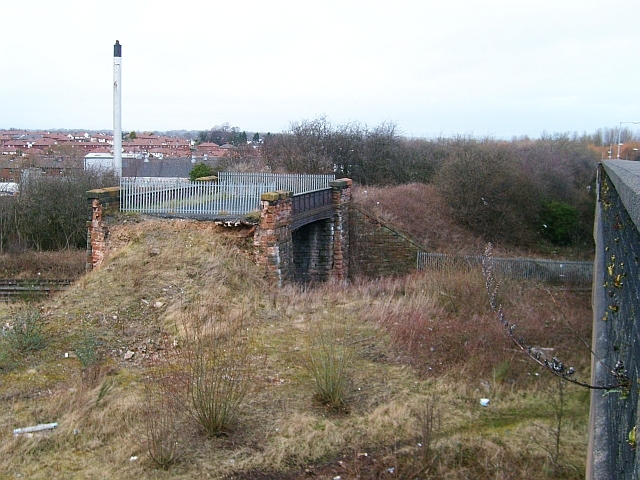
Image: © Rose and Trev Clough Taken: 1 Mar 2008
Taken from the "new" Durranhill Bridge (parapet on right), opened in 1969, which carries Eastern Way over Durranhill Road and a couple of railway lines. The old bridge stayed put, with pedestrian access, for many years. We do not know when it was demolished, but it still appears intact on Google satellite and OS Get-a-Map at time of posting. It is puzzling why this little bit, over the Carlisle to Newcastle railway, was left. For another view, see Image . The chimney on the left is at Botcherby Dairy (demolished 2010), with Botcherby housing estate behind that.
Images are licensed for reuse under creativecommons.org/licenses/by-sa/2.0
Image Location
Latitude
54.886128
Longitude
-2.901286