Burnamwood
Introduction
The photograph on this page of Burnamwood by Rose and Trev Clough as part of the Geograph project.
The Geograph project started in 2005 with the aim of publishing, organising and preserving representative images for every square kilometre of Great Britain, Ireland and the Isle of Man.

There are currently over 7.5m images from over 14,400 individuals and you can help contribute to the project by visiting https://www.geograph.org.uk
Burnamwood
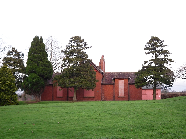
Image: © Rose and Trev Clough Taken: 19 Jan 2010
Boarded up building off Cumwhinton Drive, on the Carleton Clinic NHS site. The property was formerly part of Garlands Hospital, which was originally the Cumberland and Westmorland Lunatic Asylum. According to the website "County Asylums" http://www.countyasylums.com/mentalasylums/cumberland.htm this building was the isolation hospital, dating from 1896/7. Information update, January 2019 : since this photo was taken, the building has been demolished.
Images are licensed for reuse under creativecommons.org/licenses/by-sa/2.0
Image Location
Latitude
54.875842
Longitude
-2.88251