Air Raid Shelters
Introduction
The photograph on this page of Air Raid Shelters by David Wright as part of the Geograph project.
The Geograph project started in 2005 with the aim of publishing, organising and preserving representative images for every square kilometre of Great Britain, Ireland and the Isle of Man.

There are currently over 7.5m images from over 14,400 individuals and you can help contribute to the project by visiting https://www.geograph.org.uk
Air Raid Shelters
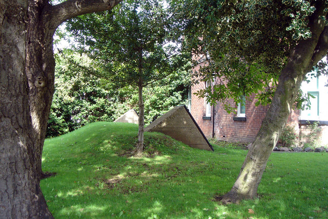
Image: © David Wright Taken: 19 Aug 2006
These shelters, an increasingly rare survival, are situated in the grounds of a former school on the corner of Westfield Road and Fleetgate.
Images are licensed for reuse under creativecommons.org/licenses/by-sa/2.0
Image Location
Latitude
53.684352
Longitude
-0.444938