Tyne View, Clara Vale
Introduction
The photograph on this page of Tyne View, Clara Vale by Andrew Curtis as part of the Geograph project.
The Geograph project started in 2005 with the aim of publishing, organising and preserving representative images for every square kilometre of Great Britain, Ireland and the Isle of Man.

There are currently over 7.5m images from over 14,400 individuals and you can help contribute to the project by visiting https://www.geograph.org.uk
Tyne View, Clara Vale
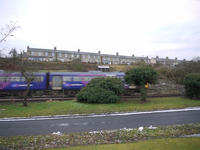
Image: © Andrew Curtis Taken: 30 Dec 2010
Photo taken from Ryton Golf Course over the Tyne Valley railway line. A community orchard of dwarf apple trees was planted in 2000 between Tyne View and the railway line by Clara Vale Conservation Group with the support of the Village Hall Committee, members of the Community and Gateshead Council http://www.england-in-particular.info/orchards/o-dham-i.html The land here was the original location of Stanner House, which along with Crawcrook Mill just south of the level crossing, were the only two buildings in this location before the village was built and the colliery developed.
Images are licensed for reuse under creativecommons.org/licenses/by-sa/2.0
Image Location
Latitude
54.980501
Longitude
-1.789193