Crow, dismantled level crossing
Introduction
The photograph on this page of Crow, dismantled level crossing by Mike Faherty as part of the Geograph project.
The Geograph project started in 2005 with the aim of publishing, organising and preserving representative images for every square kilometre of Great Britain, Ireland and the Isle of Man.

There are currently over 7.5m images from over 14,400 individuals and you can help contribute to the project by visiting https://www.geograph.org.uk
Crow, dismantled level crossing
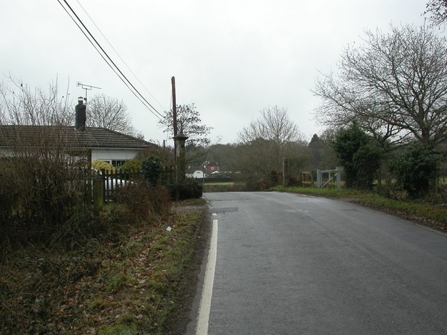
Image: © Mike Faherty Taken: 30 Dec 2010
On the road from Moortown to Burley; all that remains of the crossing is the keeper's cottage (to the left), and two concrete posts. On the former Southampton to Dorchester railway; planners are considering opening a further section, to the right, to the open forest. To the left, there is access, with a few deviations, to Poole.
Images are licensed for reuse under creativecommons.org/licenses/by-sa/2.0
Image Location


Leaflet Map data © OpenStreetMap
Latitude
50.835117
Longitude
-1.766208