The lade at Dalquhurn
Introduction
The photograph on this page of The lade at Dalquhurn by Lairich Rig as part of the Geograph project.
The Geograph project started in 2005 with the aim of publishing, organising and preserving representative images for every square kilometre of Great Britain, Ireland and the Isle of Man.

There are currently over 7.5m images from over 14,400 individuals and you can help contribute to the project by visiting https://www.geograph.org.uk
The lade at Dalquhurn
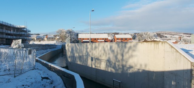
Image: © Lairich Rig Taken: 24 Dec 2010
When this picture was taken, a housing development at Dalquhurn, on what was once the site of Dalquhurn Dye Works, was still under construction. A lade that was built for the dye works had long been covered, but is being kept open as a feature of the new development, as shown here. An equivalent view from about two years earlier shows how the site has changed: Image Note that the houses appearing on the left in that photograph can also be seen in the present photograph.
Images are licensed for reuse under creativecommons.org/licenses/by-sa/2.0
Image Location
Latitude
55.964574
Longitude
-4.578203