Sundial House, Harnham
Introduction
The photograph on this page of Sundial House, Harnham by Les Hull as part of the Geograph project.
The Geograph project started in 2005 with the aim of publishing, organising and preserving representative images for every square kilometre of Great Britain, Ireland and the Isle of Man.

There are currently over 7.5m images from over 14,400 individuals and you can help contribute to the project by visiting https://www.geograph.org.uk
Sundial House, Harnham
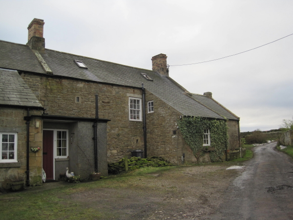
Image: © Les Hull Taken: 15 Dec 2010
Sundial House stands towards the east of the hamlet of Harnham. The central part of the building is a two floored block. A smaller cottage is built onto the west end, and a separate house joins the east end. The body of the main house is built of rubble, and the walls are 0.8m thick. Although parts of the house, such as the southern front, probably date to the 19th century, it was probably built in the 15th or 16th century. It is similar in form to a bastle, a fortified farmhouse. Old references to a Middle Stone House at Harnham may refer to this house. This is a Grade II Listed Building protected by law. http://www.keystothepast.info/durhamcc/K2P.nsf/K2PDetail?readform&PRN=N10622
Images are licensed for reuse under creativecommons.org/licenses/by-sa/2.0
Image Location
Latitude
55.118923
Longitude
-1.882694