The Greenbank roundabout, Newry (1980)
Introduction
The photograph on this page of The Greenbank roundabout, Newry (1980) by Albert Bridge as part of the Geograph project.
The Geograph project started in 2005 with the aim of publishing, organising and preserving representative images for every square kilometre of Great Britain, Ireland and the Isle of Man.

There are currently over 7.5m images from over 14,400 individuals and you can help contribute to the project by visiting https://www.geograph.org.uk
The Greenbank roundabout, Newry (1980)
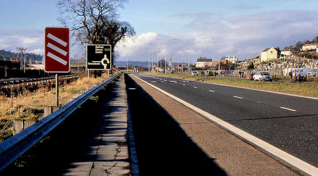
Image: © Albert Bridge Taken: 10 Feb 1980
The Greenbank roundabout is where the road to/from the Greenbank Industrial Estate joins the Newry (background) – Warrenpoint road. The approach from Warrenpoint had white-on-red countdown markers – the only place I ever saw this sign in NI.
Images are licensed for reuse under creativecommons.org/licenses/by-sa/2.0
Image Location
Latitude
54.161721
Longitude
-6.329606