Elevated houses, Cardiff Road, Newport
Introduction
The photograph on this page of Elevated houses, Cardiff Road, Newport by Jaggery as part of the Geograph project.
The Geograph project started in 2005 with the aim of publishing, organising and preserving representative images for every square kilometre of Great Britain, Ireland and the Isle of Man.

There are currently over 7.5m images from over 14,400 individuals and you can help contribute to the project by visiting https://www.geograph.org.uk
Elevated houses, Cardiff Road, Newport
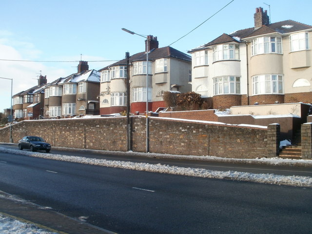
Image: © Jaggery Taken: 24 Dec 2010
On a short plateau along Cardiff Road, these houses are set several metres above road level. The plateau is only a few tens of metres long. Beyond the left edge of the view, Cardiff Road descends towards Maesglas; beyond the right edge, Cardiff Road descends http://www.geograph.org.uk/photo/2206924 towards Waterloo Road and Belle Vue Park.
Images are licensed for reuse under creativecommons.org/licenses/by-sa/2.0
Image Location
Latitude
51.574814
Longitude
-3.010049